ATLANTIC, Va. (AP) -- NASA scientists are using former military surveillance drones to help them understand more about how tropical storms intensify, which they say could ultimately save lives by improving forecast models that predict a hurricane's strength.
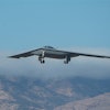
The unmanned Global Hawk aircraft were designed to perform high-altitude, long-endurance reconnaissance and intelligence missions for the Air Force. Two of the original Global Hawks built in the developmental process for the military have found new life as part of NASA's research mission, studying storms that form over the Atlantic Ocean. NASA planned to launch one of the drones from its Wallops Flight Facility on Wednesday to study Tropical Storm Gabrielle, which re-formed in the Atlantic on Tuesday.
"The biggest scientific question we're trying to attack is why do some hurricanes intensify very rapidly and why do others not intensify at all? In the last 20 years, we've made terrific progress in forecasting where hurricane tracks will go," said Paul Newman, deputy project scientist for the research mission. "But we've made almost no progress in the past 20 years in forecasting intensity."
More accurately predicting a storm's intensity would help government officials and coastal residents decide whether an evacuation is needed, as well as avoid developing a false sense of security among residents who frequently cite failed storm expectations as a reason not to leave their homes when warned to do so.
There are two questions on which NASA scientists primarily want the drone research to focus. One is what role thunderstorms within a hurricane play in its intensification. Researchers aren't sure if the thunderstorms are a driver of storm intensity or a symptom of it.
The other is what role the Saharan Air Layer plays in the tropical storm development. The Saharan Air Layer is a dry, hot, dusty layer of air from Africa. Scientists have been at odds with each other over whether it helps hurricanes strengthen or does the opposite. One school of thought is that the Saharan Air Layer provides energy for storms to grow, while others have suggested it is a negative influence on storm growth because of the effect the dry air has on wet storms.
"There's a bit of a debate in terms of how important it is, one way or the other," said Scott Braun, a research meteorologist at NASA's Goddard Space Flight Center in Greenbelt, Md., who is the drone project's principal investigator.
This is the second year NASA has launched Global Hawks from the Eastern Shore of Virginia, a strategic location that allows drones to spend plenty of time studying storms shortly after they form off the coast of Africa or as they approach the Caribbean Sea or Gulf of Mexico.
This year's mission will end later this month, and the third and final year of the project's flights will start again next August. NASA officials hope three years of flights will give them enough data to begin answering their questions.
The drones are considered advantageous over manned aircraft because they can fly for much longer periods of time than traditional research aircraft and at much greater altitudes. Global Hawks can spend up to 28 hours in the air at a time and reach altitudes up to 12.3 miles, or roughly twice that of a typical commercial airliner.
By comparison, specially equipped P-3 Hurricane Hunter aircraft that fly directly into a storm typically do so at low altitudes of 1,000 to 10,000 feet. Researchers say having a broad overview of a storm can help them understand things such as whether air moving away from a storm helps it intensify.
"As a Hurricane Hunter goes through a storm, they get very detailed information," Newman said. "Imagine that this (Global Hawk) will do kind of a cat scan of a hurricane, but Hurricane Hunters go in and it's like you're using a fine scalpel to look at the details of the patient, if you will."
NASA Hurricane and Severe Storm Sentinel https://espo.nasa.gov/hs3/


